Leading experts gather in Rome to share knowledge on the latest developments in peatland monitoring
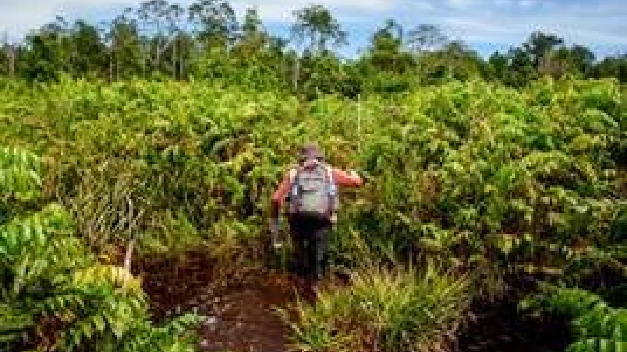
Representing the most carbon-dense terrestrial ecosystem, peatlands can be found in all climatic zones across 169 countries worldwide. Their sustainable management, restoration and conservation play a crucial role in the process of tackling climate change, as drained and degraded peatlands represent a major source of greenhouse gas emissions, releasing an estimated 5 percent of anthropogenic greenhouse gas emissions globally. As more and more countries are joining the efforts to halt further conversion and restore this precious type of wetlands, the need for robust tools and integration of various tools into a holistic land use monitoring system has never been more obvious.
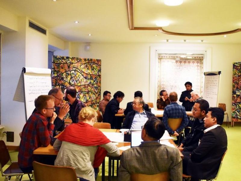
In recent years, the world has seen remarkable advances in both mapping of new peatland areas and the development of innovative approaches to monitor them. To step up peatland monitoring and strengthen partnerships between key actors in this field, Food and Agriculture Organization of the United Nations (FAO) organized a scientific and technical knowledge exchange at its headquarters in Rome. The event gathered country representatives and leading experts from multilateral and non-governmental organisations to share experiences and lessons learned in monitoring for sustainable management of peatlands.
Held on 22–23 May, the workshop offered a unique opportunity for the leading actors in the field of remote sensing and field-based peatland monitoring as well as experts from national agencies setting up monitoring systems, to exchange knowledge and lessons learned on the latest technical advancements. The participants reviewed state-of-the-art approaches to peatland monitoring and shared tools, approaches and challenges in assessing the status and change of peatlands cover. Specifically, the workshop focused on key indicators of greenhouse gas emissions in tropical regions: groundwater level and soil moisture, and subsidence of drained peatlands, and detection of land use change, such as the appearance of new drainage canals.
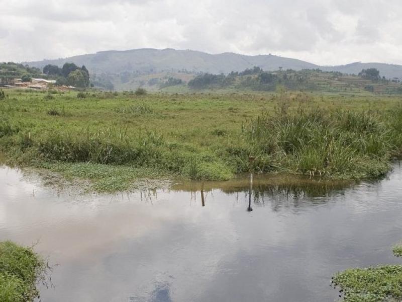
02 October 2008, Rugezi – A view of the marshlands. FAO Project: EP/RAF/401/GEF: Trans-boundary Agro-Ecosystem Management Programme for the Lower Kagera River Basin, PDF-B. The natural resources of the Kagera river basin, which rises in Burundi and flows through Rwanda, Uganda and Tanzania into Lake Victoria, are facing increasing pressures and degradation as a result of population pressures, the intensification of agricultural and livestock activities and unsustainable land use systems and management practices. The basin’s land and freshwater resource base, its associated biodiversity and thereby human livelihoods and food security are threatened by declining productivity capacity and resource value of the cropland, rangeland and forests and by wetland encroachment. The PDF-B grant aims to improve knowledge and strengthen capacities at local, technical and policy levels for the preparation of an integrated agro-ecosystems and biodiversity management framework, known as the Transboundary Agro-ecosystems Management Programme (TAMP). The full scale project will support the implementation of TAMP with the long-term goal of protecting the integrity of the ecosystems of the lower Kagera Basin and harnessing global environmental benefits through ensuring the productive and sustainable use of the biodiversity resources and agricultural ecosystems. The TAMP will mobilise the adoption of productive and sustainable land management and livelihood strategies of local populations in range, agro-pastoral and arable lands. An integrated ecosystem management approach across the transboundary river basin will help combat degradation, rehabilitate degraded lands and achieve local and global environmental benefits in terms of biodiversity conservation, protection of international waters and mitigating the effects of climate change through enhanced carbon sequestration.
35 participants discussed the crucial role that robust monitoring systems play in advising on decision-making and policies aimed at improving management of peatland landscapes and livelihood of communities who depend on them. The participant list included country representatives from numerous government entities responsible for peatland monitoring and restoration in Indonesia, Peru and Russia, as well as representatives from various organizations and research institutes with either expertise or needs on peatland monitoring, such as the well as Agency for the Assessment and Application of Technology (BPPT), the Center for International Forestry Research (CIFOR), the European Space Agency (ESA), the Greifswald Mire Centre (GMC), Hokkaido University, the International Fund for Agricultural Development (IFAD).
One of the participants, Mr Albertus Sulaiman from the Agency for the Assessment and Application of Technology (BPPT) in Indonesia highlighted the complexity and cost of peatlands monitoring. “To find efficient ways to monitor this precious resource, we should bring all the actors together to share experiences, ideas and discuss possible solutions to many challenges we face. It will be also crucial to keep the discussion going and stay connected even after the workshop,” he added.
The workshop was organised under the framework of the Peatland Restoration Information and Monitoring System (PRIMS), an initiative to support information transparency on peatland restoration measures in Indonesia, as well as the Global Peatland Initiative (GPI) project funded by the German International Climate Initiative (IKI).
FAO’s work on peatlands
Dedicated to supporting the development of responsible peatland management, FAO assists countries through:
- Technical support at the regional, national and field level in particular on peatland monitoring,
- Knowledge sharing and capacity development, as well as
- Policies and governance such as integration of peatlands into national plans and reporting.
Together with 28 partner organizations of the Global Peatlands Initiative, FAO currently supports countries in advancing in sustainable peatland management and works with partners in different frameworks, such as the REDD+ (Reducing Emissions from Deforestation and Forest Degradation); Global Soil Partnership; the Land degradation neutrality framework; and Global Partnership on Forest and Landscape Restoration.
“FAO has extensive experience in supporting countries in developing land use monitoring systems. Now this experience becomes important as countries are developing further their responsible peatland monitoring and integrating it into existing measurement and reporting systems. By improving peatland-related decisions, we aim to improve management for people, biodiversity and climate,” said Forestry Officer Maria Nuutinen, highlighting the role FAO’s REDD+ /National Forest Monitoring Cluster plays in the process. “Partnership and knowledge created during the exchange will help countries achieve their Paris Agreement and Sustainable Development Goals commitments and will eventually path ways for further improvement of the state of peatlands globally.”
Useful links:
More on FAO’s work on peatlands, more on Global Peatlands Initiative , further resources by the Indonesian Ministry for Environment and Forestry attending the workshop: http://pkgppkl.menlhk.go.id
Link to the original article: http://www.fao.org/redd/news/detail/en/c/1195808/